REGIÓN DE TRABAJO DEL PRODII
La región donde PRODII trabaja, se ubica en el Norte del Departamento de Potosí, abarca una superficie total de 12.764 km.2, y representa el 10,79 % del total del territorio departamental. Limita al Norte con el Departamento de Cochabamba, al Oeste con Oruro, al Este con Chuquisaca y al Sud con las provincias Tomas Frías y Saavedra. Está conectada tangencialmente por la carretera Interdepartamental Potosí – Oruro. El resto de las carreteras son interprovinciales e intermunicipales empedradas o de terracería, algunas de las cuales son interrumpidas temporalmente en época de lluvia. Por ello, haciendo una relación con otras regiones del departamento y del nivel nacional, el Norte de Potosí se encuentra con menor conectividad. Y por tanto la ubicación geográfica no representa una ventaja importante para la región. Con el transcurrir de los años, PRODII ha extendido sus acciones al Sur de Oruro, Norte de Chuquisaca, y el Valle Alto de Cochabamba, en zonas con similitudes de problemas y potencialidades.
En referencia a la población, de acuerdo al censo del año 2001, la población de Bolivia alcanza 8.3 millones de habitantes, siendo Potosí el cuarto departamento en tamaño en población en el país después de La Paz, Santa Cruz y Cochabamba. Para ese año el tamaño de población del departamento, se acercaba a los 709 mil habitantes, representando aproximadamente el 9% del total nacional. En este contexto la población de la región ascendía al 34% (aproximadamente 243.000 habitantes) de la población total del departamento de Potosí. La tasa media anual de crecimiento de la población (que incluye tanto el comportamiento vegetativo de la población, como el balance migratorio) era negativa para el periodo 1976 – 1992, con una densidad media rural alta de 19,04 hab/Km2.
De acuerdo al INE 2001, el 89 % de la población de la región corresponde a las categorías de pobreza moderada (15%) indigencia (52 %) y marginalidad (23 %). La falta de alimentos es un problema crónico: casi el 75 % de la población infantil padece de malnutrición, el 23 % sufre de estados de desnutrición. Así la esperanza de vida de la región no supera los 56 años de edad, por debajo de los 60 y 65 años del nivel departamental y nacional respectivamente. Por otro lado, alrededor del 73% de las mujeres y del 50% de los hombres sólo hablan quechua. Existe una estrecha correlación entre el analfabetismo y monolingüismo de las mujeres y su débil participación en la vida política regional. Solamente el 33% de las mujeres en edad de votar están inscritas en el padrón electoral.
Con excepción de los centros poblados importantes, los hogares de las serranías carecen de electricidad, de agua y de instalaciones sanitarias. En los ámbitos rurales de la región, los centros de salud, las escuelas, así como las posibilidades de comunicación son escasas, y a raíz del insuficiente desarrollo de la red de carreteras y de la falta de medios de transporte, la mayoría de la población no tiene acceso a estos servicios. Gran parte de la población se ve obligada a migrar por lo menos temporalmente a ciudades como Cochabamba o a la región tropical del Chapare como jornaleros.
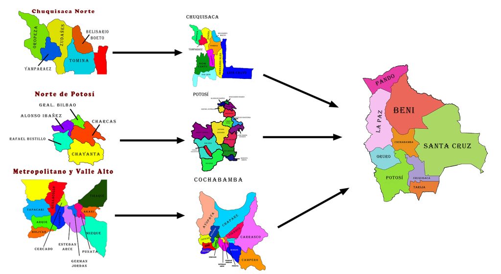
Por las características topográficas, funcionales, y territoriales, la región se subdivide funcionalmente en tres subregiones: el Extremo Norte, que considera a las provincias de Charcas, Bernardino Bilbao Rioja y Alonso de Ibáñez; (con 6 municipios: San Pedro de Buenavista, Toro Toro, Acacio, Armapampa, Sacaca y Caripuyo); y la subregión del Norte Centro, que comprende a la provincia Rafael Bustillos (con 4 municipios: Uncía, Llallagua, Chuquihuta y Chayanta); y la subregión Nor Este que comprende a la provincia Chayanta (con 4 municipios: Colquechacha, Pocoata, Ocurí y Ravelo). Por su posición geográfica y topografía accidentada, con mayor o menor ponderación mantienen mayor comunicación y vínculos comerciales con Oruro y Cochabamba.
En cuanto a la división política: comprende a 5 provincias y 14 municipios. La división política administrativa es en distritos y cantones; en los 14 municipios son 90 cantones y/o distritos y 1.557 comunidades.
A pesar de los cambios socio económicos y político organizativos sobre el territorio, el “Ayllu” sigue siendo la unidad de organización de las comunidades andinas que les permite asegurar la reproducción de su economía agrícola y pecuaria, a través de una estrategia agrícola básica que les permite el acceso a tierras discontinuas y de diversidad ecológica. De esta forma, la familia es propietaria de diversos espacios ubicados en diferentes microclimas y realiza un mejor aprovechamiento de las formaciones geomorfológicas, distribuyendo y amortiguando los daños por eventuales fenómenos climáticos adversos.
Existe una utilización intensiva y diferenciada de los diferentes pisos ecológicos, con sistemas de rotación de cultivos y de áreas de cultivo, así como de pastoreo. La intensificación de estas actividades ha incidido en el deterioro del recurso suelo, la reducción de la biodiversidad y la reducción de las fuentes de agua.
PRODII’S AREA OF WORK
PRODII’S AREA OF WORK
The region where PRODII works is situated in the north of the department of Potosí, covers a total area of 12,764 km2, and represents 10.79% of the department’s territory. To the north it borders the department of Cochabamba, the department of Oruro to the west and the department of Chuquisaca to the east, and the provinces of Tomas Frías and Saavedra to the south. It is connected tangentially by the Interdepartmental Highway Potosí – Oruro. The other roadways are interprovincial and intermunicipal cobblestone or dirt roads, some of which become temporarily impassable during the rainy season. For this reason, in comparison to other regions of the department and on a national level, the North of Potosí is less connected. Therefore, its geographic location represents a disadvantage for the region. Over the years, PRODII’s actions have expanded into the South of Oruro, the North of Chuquisaca, and the Valle Alto of the department of Cochabamba, where similar problems and potentials exist.
According to the 2001 census, the population of Bolivia reached 8.3 million inhabitants, with Potosí being the fourth largest department in size after La Paz, Santa Cruz, and Cochabamba. In that year the population of the department was nearly 709,000 inhabitants, representing approximately 9% of the national total. In that context the population of the region amounted to 34% (approximately 243,000 inhabitants) of the total population of the department of Potosí. The average annual population growth rate (which includes both the nonmigratory population and the migratory balance) was negative for the period of 1976 – 1992, with a high average rural density of 19.04 inhabitants/km2.
According to INE 2001, 89% of the population of the region falls into the categories of moderate poverty (15%), indigence (52%), and marginalization (23%). Lack of food is a chronic problem; almost 75% of the child population suffers from malnutrition, and 23% suffer from undernourishment. Therefore, the life expectancy of the region does not exceed 56 years of age, below the expectancy of 60 and 65 years on the departmental and national levels, respectively. Additionally, approximately 73% of women and 50% of men only speak Quechua. There is a close correlation between women’s illiteracy and monolingualism and their weak participation in regional political life. Only 33% of women who are of voting age are registered on the electoral roll.
With the exception of the major population centers, households in the highlands lack electricity, water, and sanitation facilities. In the rural areas of the region, health centers, schools, and means of communication are scarce, and due to insufficient development of roads and lack of means of transportation, the majority of the population cannot access these services. Much of the population is forced to migrate at least temporarily to cities like Cochabamba or the tropical region of Chapare to work as day laborers.
Due to its topographical, functional, and territorial characteristics, the region is functionally divided into three subregions: the Extreme North, which is comprised of the provinces Charcas, Bernardino Bilbao Rioja and Alonso de Ibáñez (with 6 municipalities: San Pedro de Buenavista, Toro Toro, Acasio, Arampampa, Sacaca and Caripuyo); the subregion of the Center North, which is made up of the province Rafael Bustillos (with 4 municipalities: Uncía, Llallagua, Chuquihuta, and Chayanta); and the subregion North East, which is made up of the province of Chayanta (with 4 municipalities: Colquechaca, Pocoata, Ocurí, and Ravelo). Because of its geographical position and its rugged topography, the greatest communications and trade links are maintained with Oruro and Cochabamba.
Regarding political division, the region has 5 provinces and 14 municipalities. The administrative political division is in districts and cantons; in the 14 municipalities there are 90 cantons and 1,557 communities.
Despite socioeconomic and political-organizational changes in the territory, the “Ayllu” continues to be the organizational unit of Andean communities, which allows them to ensure the reproduction of their agricultural economy through a basic agricultural strategy that permits them access to discontinuous and ecologically diverse lands. In this model, the family owns diverse spaces located in different microclimates and can make better use of geomorphological formations, distributing and protecting against the damages caused by eventual adverse climate phenomena.
There is intensive and differentiated use of different ecological zones, with crop rotation systems as well as rotation of crop areas and grazing areas. These intensifying activities have led to the deterioration of soil resources, reduction of biodiversity, and reduction of water sources.